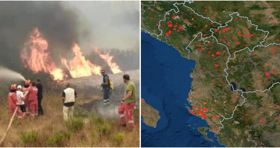
While forest fires continue to affect different regions in the Mediterranean and the Western Balkans, Abcnews.al, referring to data from NASA, has provided satellite images of active fires in the last 24 hours in our country, in the region and beyond.
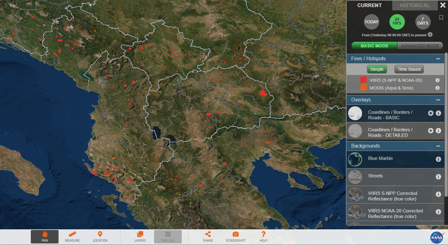
As seen on maps from NASA satellites, in Albania, fires are focused in the south of the country, but large fires are also seen in the north. In the north of the country, the most problematic seems to be the recent fire in the area of Has.
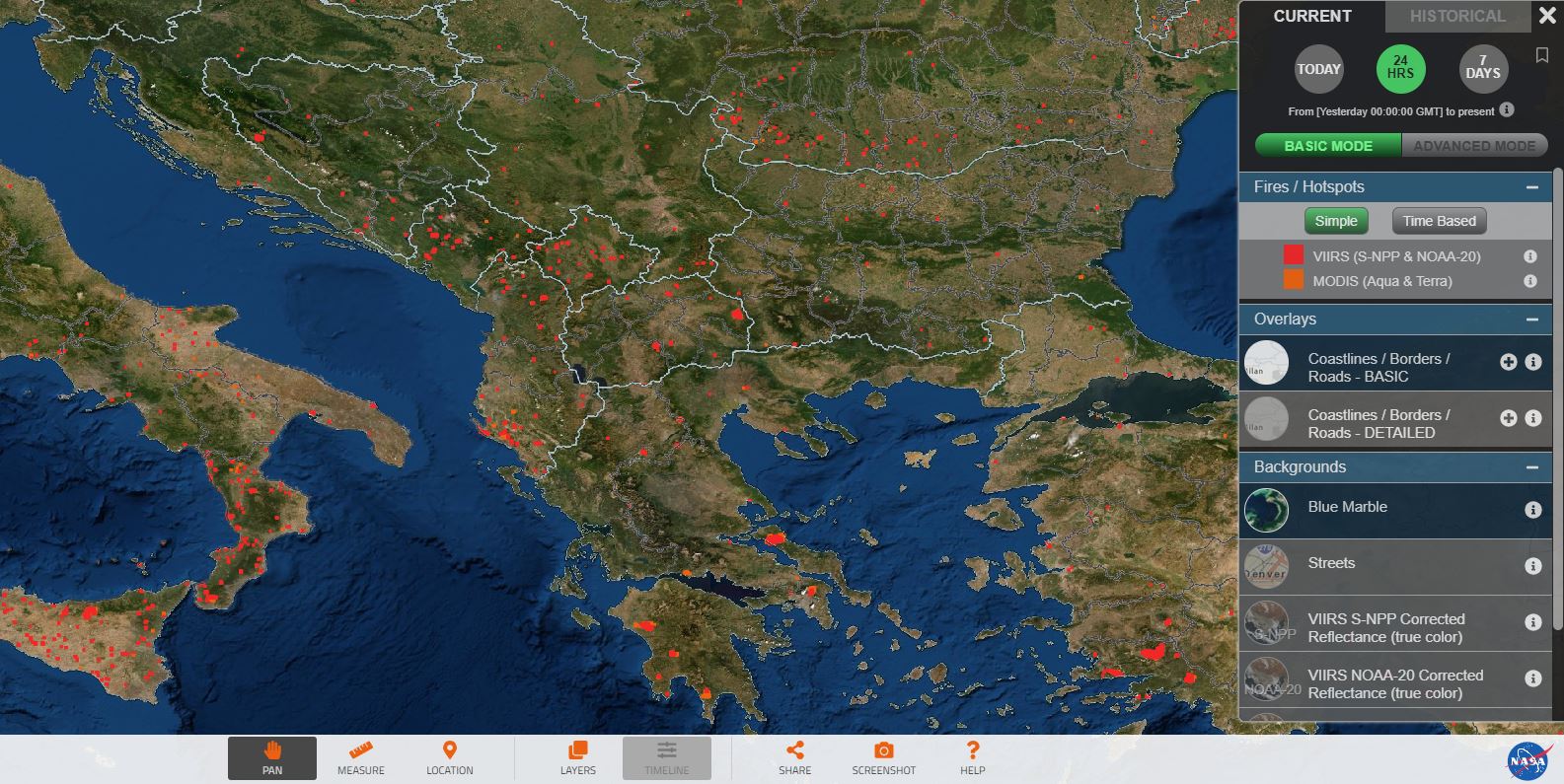
Meanwhile in the south of the country, the situation seems dire in the area of Vlora and surrounding, where red dots indicate active fires during the last 24 hours.
The map also shows that a large part of the region, such as Macedonia, Kosovo or Montenegro. Meanwhile, large fires are being recorded in Greece as well.
Meanwhile, some of the fires in our country have been isolated, but some others remain active. The news is announced by the Ministry of Defense in the next report on the situation of fires in the country.
It is reported that in Karaburun work is continuing for the total extinguishing of the flames, although most of it has been closed. There is currently no risk. In Gjirokastra the situation is said to have been neutralized. However, an outbreak remains active in the village of Saraqinisht, which poses no danger.
The fire in the village of Gadurovë, in Mallakastër is under control and without danger, while the fire in the village of Cukal, in Shkodër continues to be active, but without identified risks.
In the mountain of Shengjin, in Lezha, the hearth is isolated while the fire in the village of Kalis, in Kukës is being kept under control. The risk to housing has been eliminated.
Meanwhile, the fire situation continues to be problematic in Maja e Rruna, in Kukës. The flames have engulfed most of the mountain, but the situation, according to the Defense, is being kept under control so as not to endanger the dwelling.